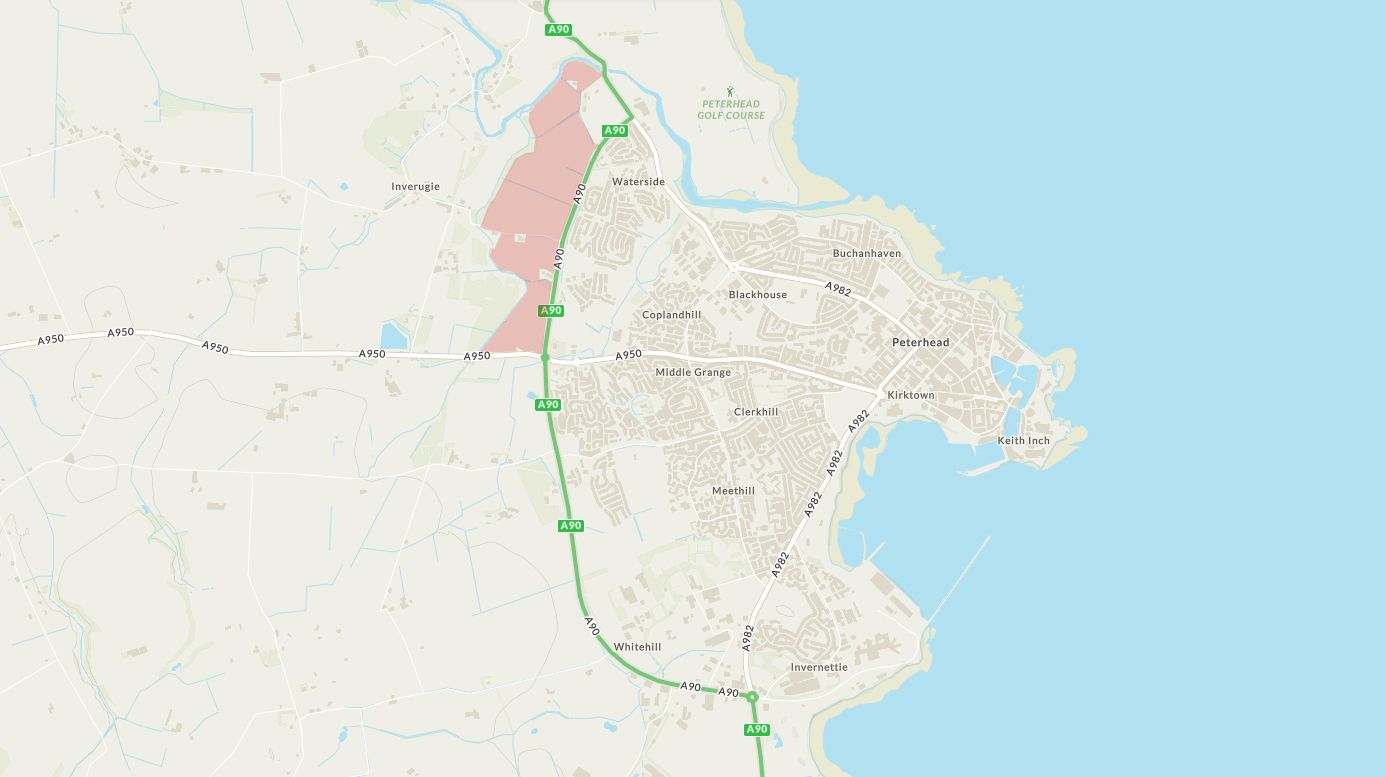
The adopted Aberdeenshire Local Development Plan 2017 requires a Masterplan to be prepared and approved for South Ugie to support planning applications being brought forward for the site and development taking place.
The long term vision for development of the land is set out in the South Ugie Development Framework, which was approved by Aberdeenshire Council in October 2016. The framework establishes the foundations for the sustainable growth of Peterhead up to 2035.
A new Masterplan, which is being prepared for Claymore Homes, covers the majority of the land allocated for development in the Local Development Plan (Site OP 1) building on the provisions laid out in the 2016 masterplan.
The A90 Trunk Road runs along the full length of the site’s eastern boundary from the junction with the A982 at the northern end of the site to the Howe of Buchan Roundabout at the southern end. The River Ugie runs along the north western boundary of the site and the former Formartine and Buchan railway line route traverses the site in an east to west direction close to Inverugie. Despite part of the site’s close proximity to the sea, the site is landbound and its physical associations are with the agricultural hinterland rather than the coast. The southern end of the site is bounded by the A950 Road to Longside.
The proposal is a large scale residential led mixed-use development consisting of circa 800 units, a local neighbourhood centre, land reserved for employment purposes, a primary school and a potential future rail halt, associated roads and drainage infrastructure, new landscaping and open spaces and a local nature reserve. This will be delivered over phases providing much needed new housing for Peterhead and supporting land uses, community facilities, open spaces and infrastructure to support a sustainable new community.